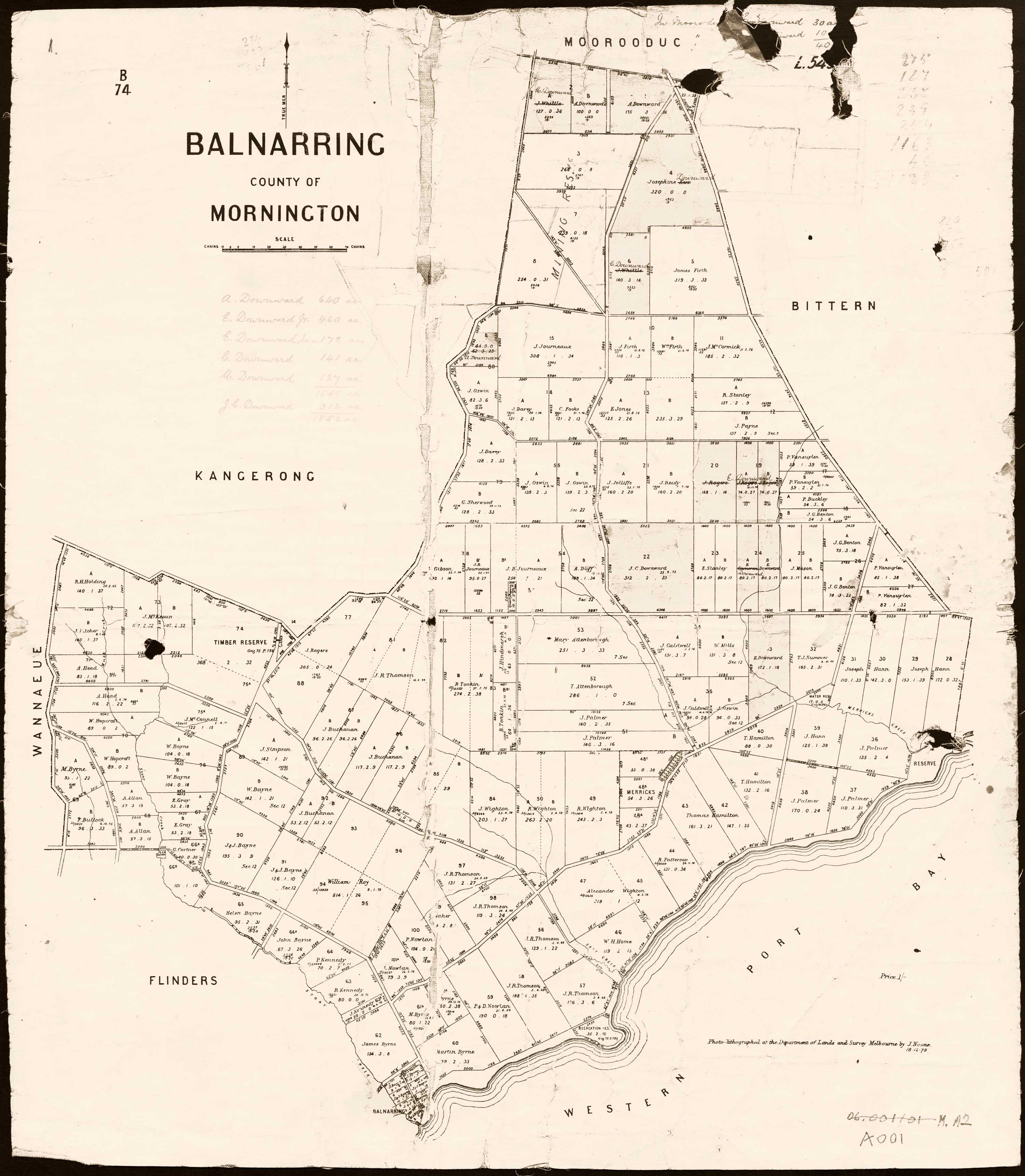
You may be wondering why ‘Balnarring’ is marked on the coast of the map used as our website background.
This early map of the Parish of Balnarring (1871) shows three proposed townships. One is central and inland. Two are on the coast; one at the western parish boundary and one at the eastern boundary.
At that time, transport by boat was more reliable and faster as roads were little more than tracks. The central township of the Parish is Merricks, the eastern coastal one is Tulum and the western township has the name Balnarring.
At first glance this might appear to be a mistake but Balnarring did not develop as a township until later and then, not as planned.
Balnarring’s first ‘centre’ was the homestead of P. VanSuylen who used his home as a store, the post office then an inn. Balnarring evolved along the road that formed the Parish’s eastern boundary and led to Mornington.
The coastal ‘Balnarring’ was known as Stony Creek, Balnarring. In 1881 the settlement at Stony Creek changed its name to Shoreham to avoid confusion especially with the mail service. Shoreham did see a fair amount of coastal trade to and from its jetty which was built in the late 19th C. Tulum was not a suitable site for a jetty to accommodate shipping.


 Balnarring & District Historical Society